")
The Tawang – Bum La Cycling Expedition is a rare opportunity to ride into the remote and mystical landscapes of Arunachal Pradesh, one of India’s most captivating Himalayan regions. Beginning from Tawang (10,000 ft)—a town famous for its spiritual aura, majestic monasteries, and panoramic mountain views—the journey takes you on a challenging yet rewarding cycling route that culminates at Bum La Pass (15,200 ft), a strategic and historic Indo–China border crossing.
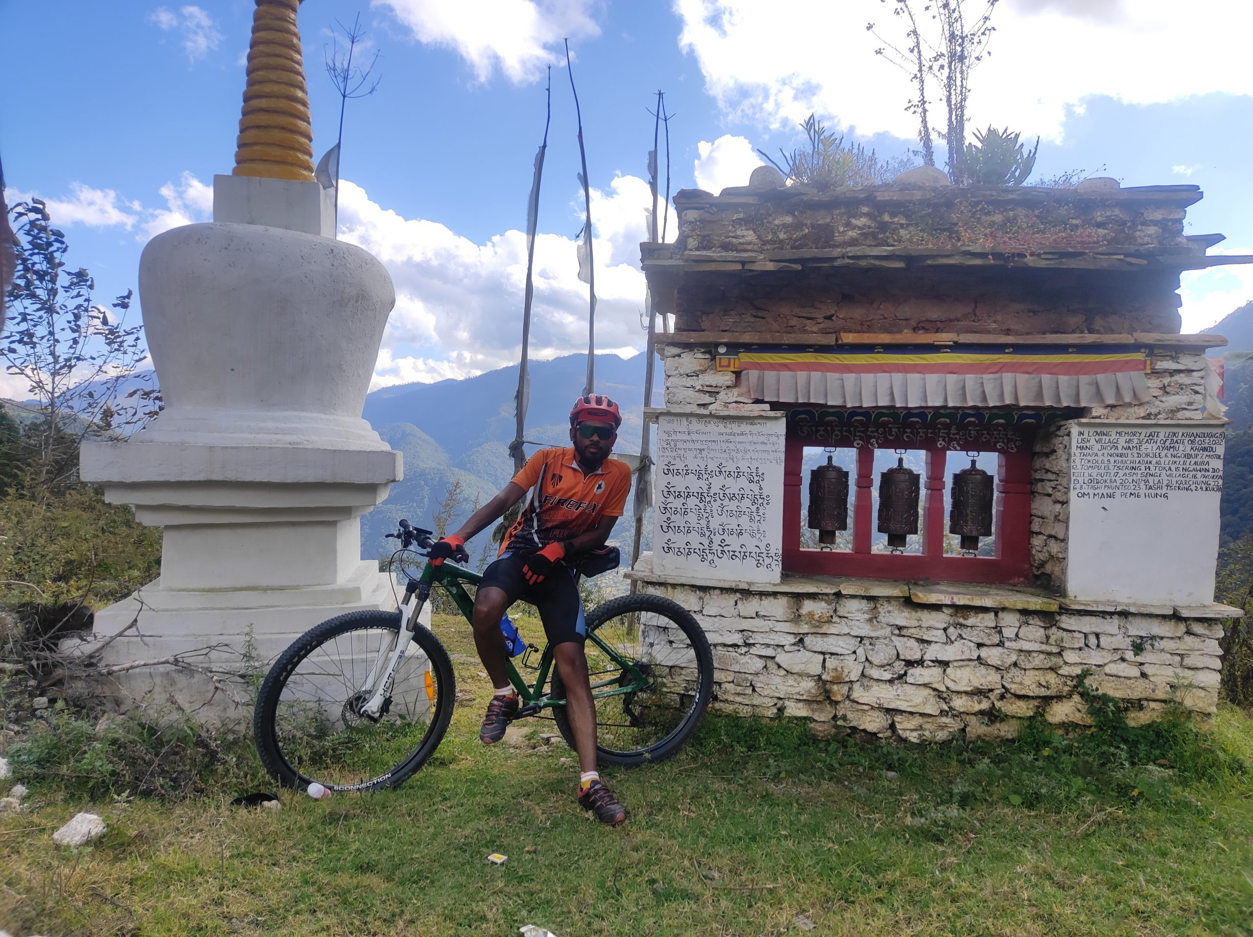
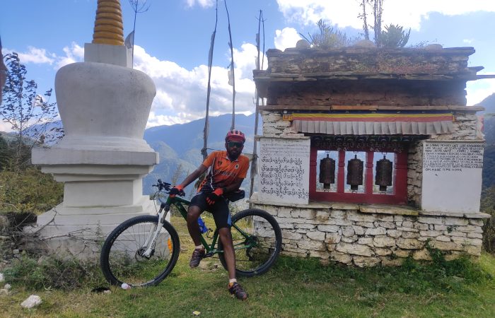
This expedition blends raw adventure with cultural immersion and patriotic spirit. Over the course of the ride, you’ll pedal across endless mountain switchbacks, pine-clad valleys, and high-altitude lakes shimmering with crystal-clear waters. The ever-thinning air tests your stamina, while prayer flags fluttering in the cold winds remind you of the deep-rooted Buddhist traditions of the Monpa people.
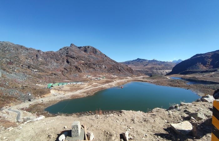
Along the way, you’ll explore Tawang Monastery—the largest monastery in India and a beacon of Tibetan Buddhism, marvel at glacial lakes like Sangetsar (Madhuri) Lake, and pass through strategic army outposts echoing the tales of the 1962 Indo–China War. The final climb to Bum La Pass is nothing short of legendary—a steep, unrelenting ascent that demands every ounce of endurance, but rewards you with sweeping views of snow-capped peaks, the Indo–China border gates, and the proud sense of standing at one of India’s most important frontiers.
Unlike conventional Himalayan cycling expeditions in Ladakh or Himachal, the Tawang–Bum La route remains raw, less commercialized, and deeply cultural. You’re not just riding to a high pass—you’re riding into a land where history, spirituality, and patriotism converge, making it one of the most meaningful cycling adventures in the country.
Briefing Duration: 2 hours approx. | Altitude: Guwahati – 55 m | Stay: Hotel.
Arrive at Guwahati, the gateway to Northeast India. Meet your expedition leader and fellow cyclists for a detailed briefing session on the route, safety instructions, high-altitude cycling, and team coordination. Evening free to explore Guwahati city or rest before the journey.
Drive Distance: 240 km approx. | Drive Duration: 8-9 hours approx. | Altitude: Bhalukpong – 213 m | Stay: Hotel. | GPS DATA
A scenic drive through Assam’s plains into the foothills of Arunachal Pradesh. You cross lush green tea gardens, Brahmaputra plains, and small towns before reaching Bhalukpong, the entry point to Arunachal Pradesh. Situated on the banks of the Kameng River, it’s a perfect spot to relax before starting the cycling adventure.
Ride Distance: 60 km approx. | Duration: 7-8 hours approx. | Altitude: Jamiri – 1295 m | Stay: Hotel. | GPS DATA
The first cycling day! The route gradually climbs into the Eastern Himalayas, with winding roads, forested slopes, and refreshing mountain streams. The ascent is steady and will test endurance as the altitude increases. You’ll end the day at Jamiri, a quiet mountain settlement surrounded by hills.
Ride Distance: 50 km approx. | Duration: 6-7 hours approx. | Altitude: Bomdila – 2415 m | Stay: Hotel. | GPS DATA
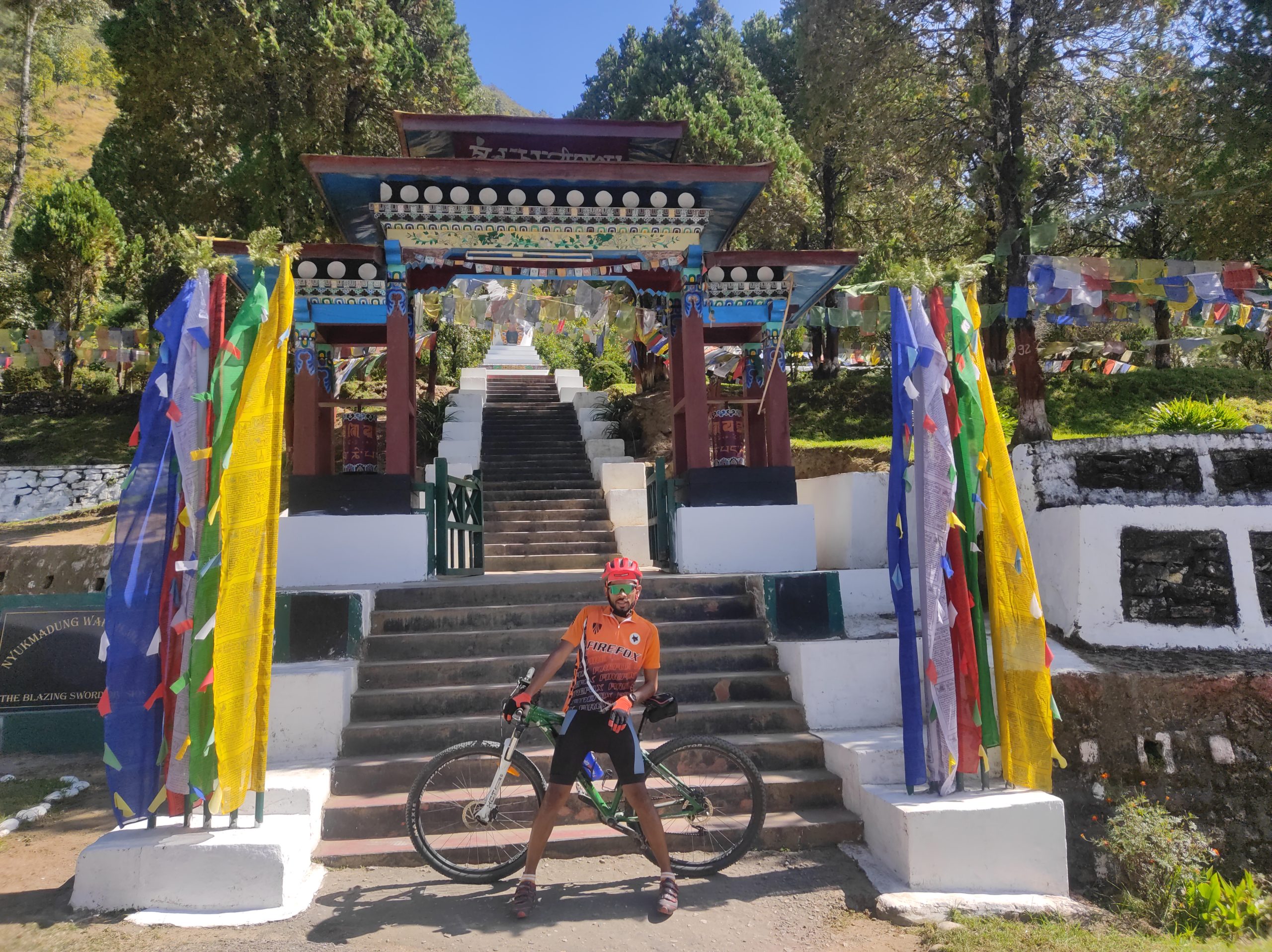
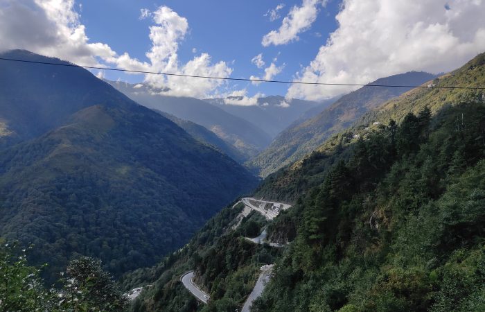
A steep ascent day as you climb higher into Arunachal’s mountains. Bomdila is a bustling hill town known for its Buddhist monasteries, apple orchards, and stunning views of snow-clad ranges. The change in landscape and climate will be noticeable here as you pedal into cooler altitudes.
Ride Distance: 50 km approx. | Duration: 7-8 hours approx. | Altitude: Sangti – 1652 m | Stay: Hotel. | GPS DATA
A relatively easier day with mixed climbs and descents. The route takes you to Sangti Valley, one of the most picturesque valleys in Arunachal, famous for its lush meadows, pine forests, and black-necked cranes (seasonal migratory birds). A chance to unwind amidst pristine nature.
Ride Distance: 35 km approx. | Duration: 5-6 hours approx. | Altitude: Senge – 2900 m | Stay: Hotel. | GPS DATA
The road climbs steadily again as you move towards higher altitudes. You’ll feel the oxygen levels drop as the climb progresses. Senge is a mountain hamlet and an important stop before the climb to Se-La Pass.
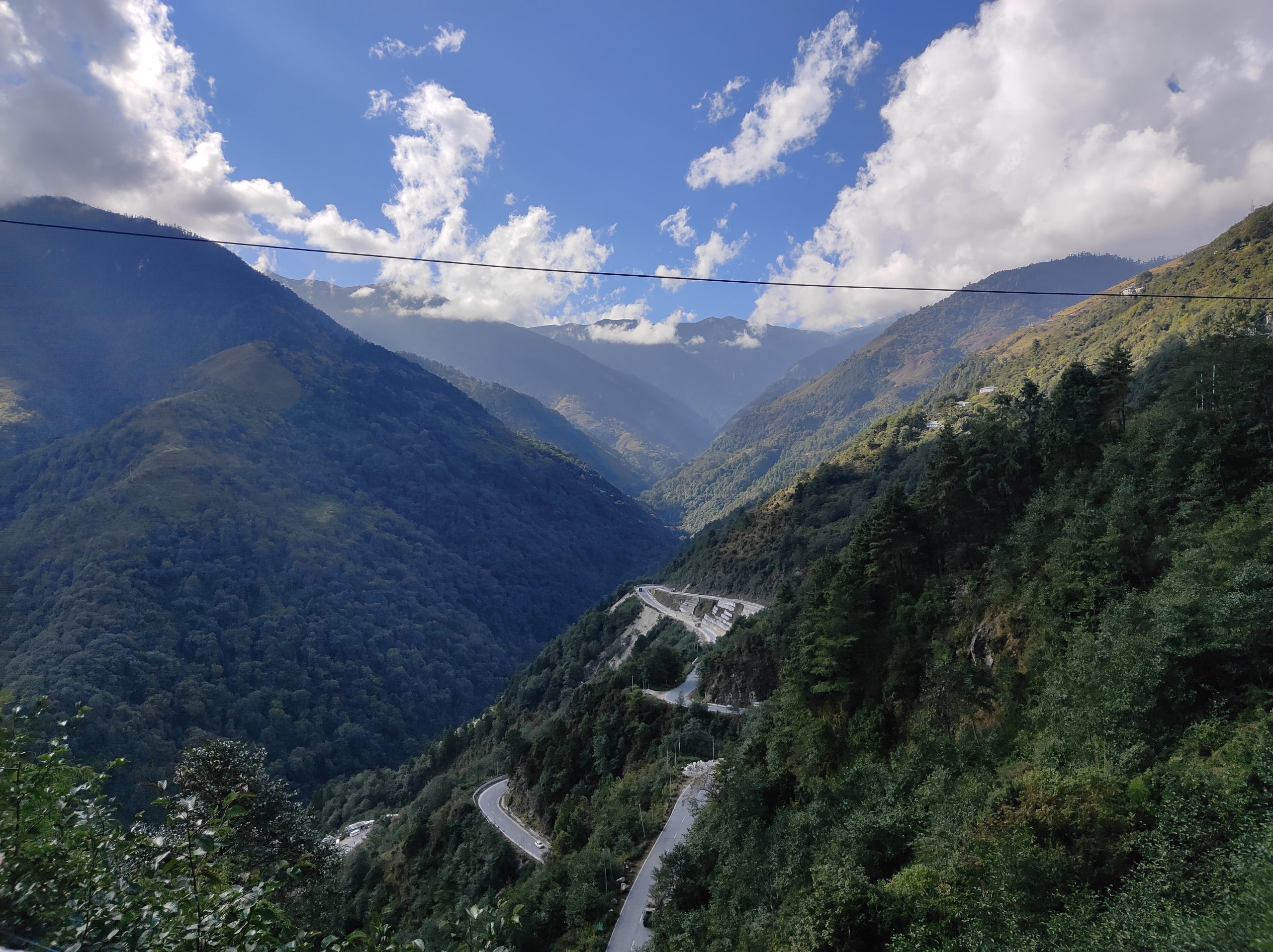
Ride Distance: 66 km approx. | Duration: 8-9 hours approx. | Altitude: Se-La – 4200 m | Jung- 2400 m | Stay: Hotel. | GPS DATA
A tough but rewarding day! The climb to Se-La Pass (13,700 ft / 4,200 m) is one of the highlights of the expedition. The road winds past alpine landscapes, frozen lakes, and snow walls. After crossing the pass, enjoy a thrilling descent into Jung, a village surrounded by waterfalls and valleys.
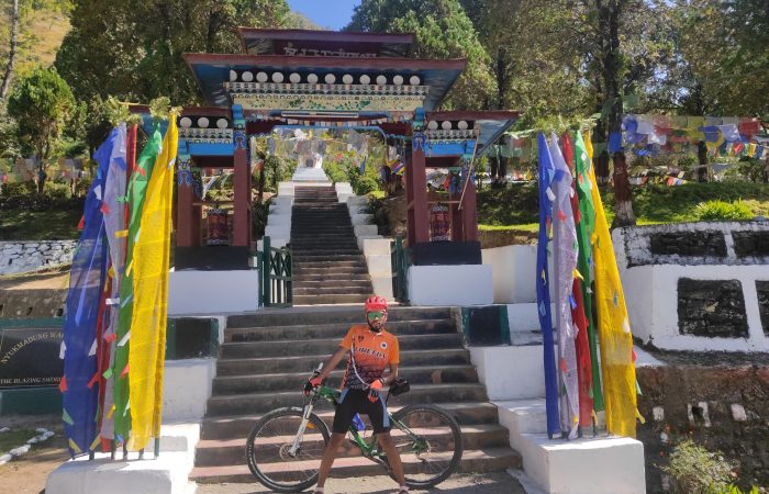
Ride Distance: 40 km approx. | Duration: 6-7 hours approx. | Altitude: Tawang- 3048 m | Stay: Hotel. | GPS DATA
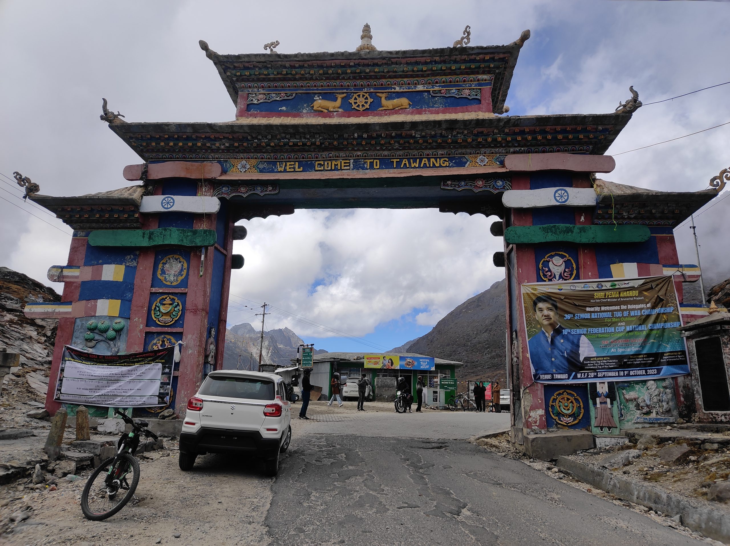
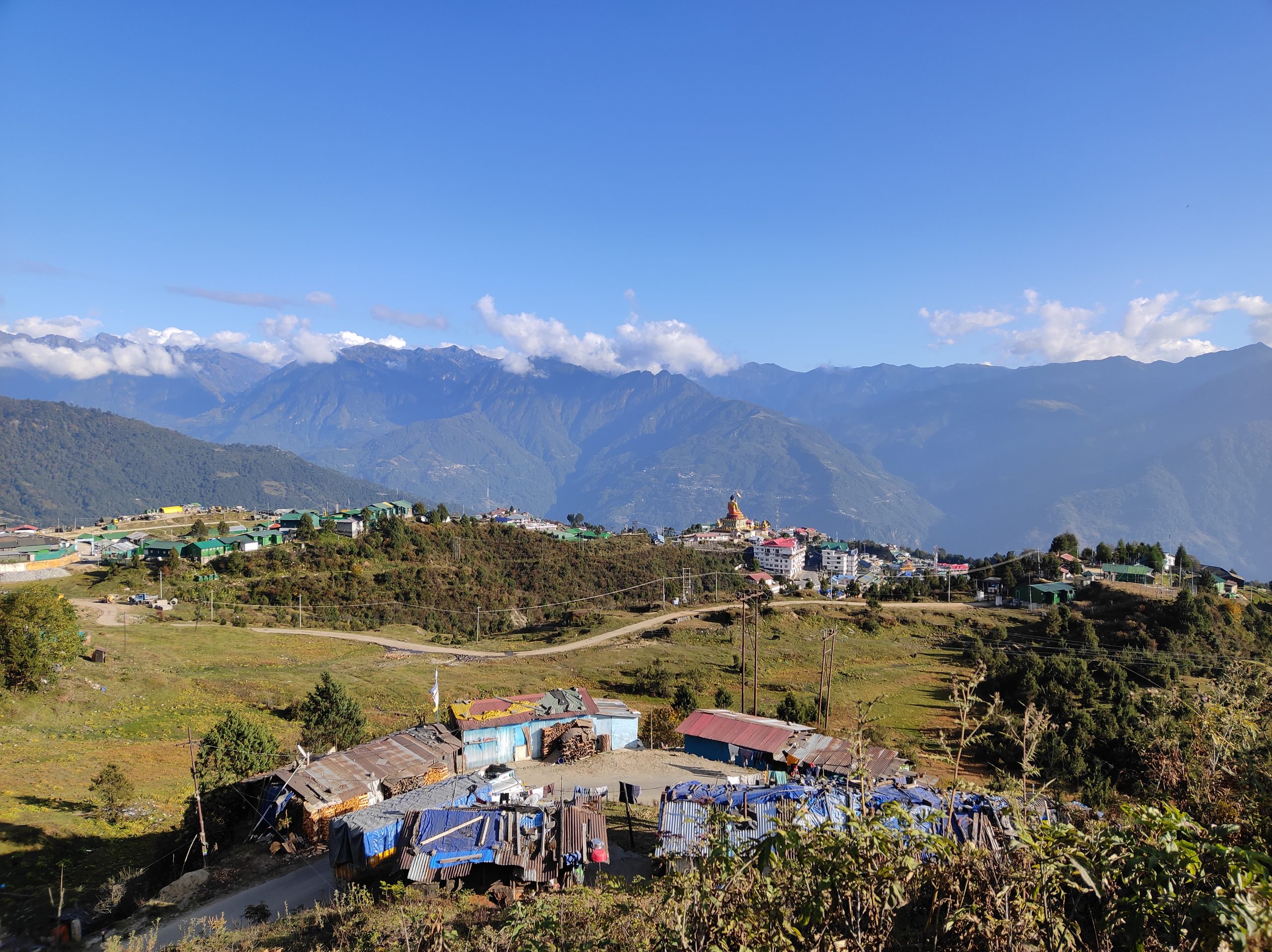
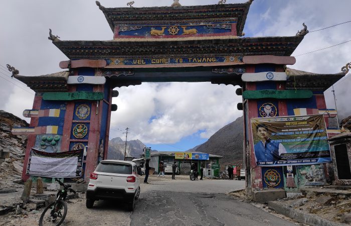
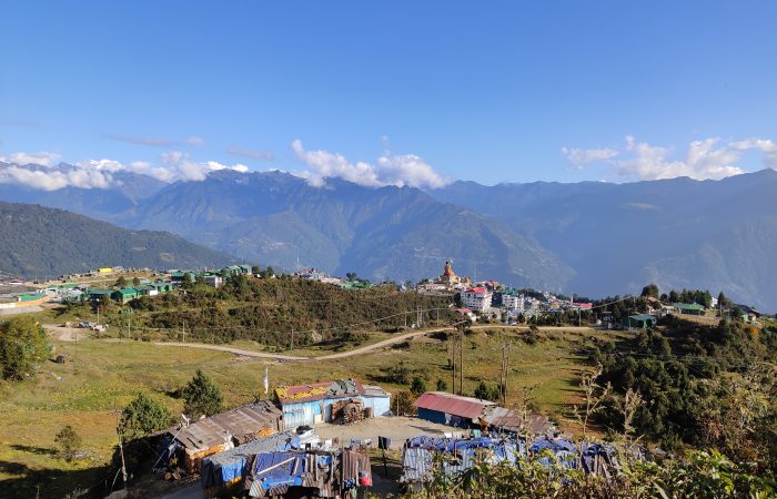
A shorter but scenic ride to Tawang, the cultural heart of Arunachal Pradesh. Tawang is home to the famous Tawang Monastery, the second-largest in the world. Evening free to explore local markets and monasteries.
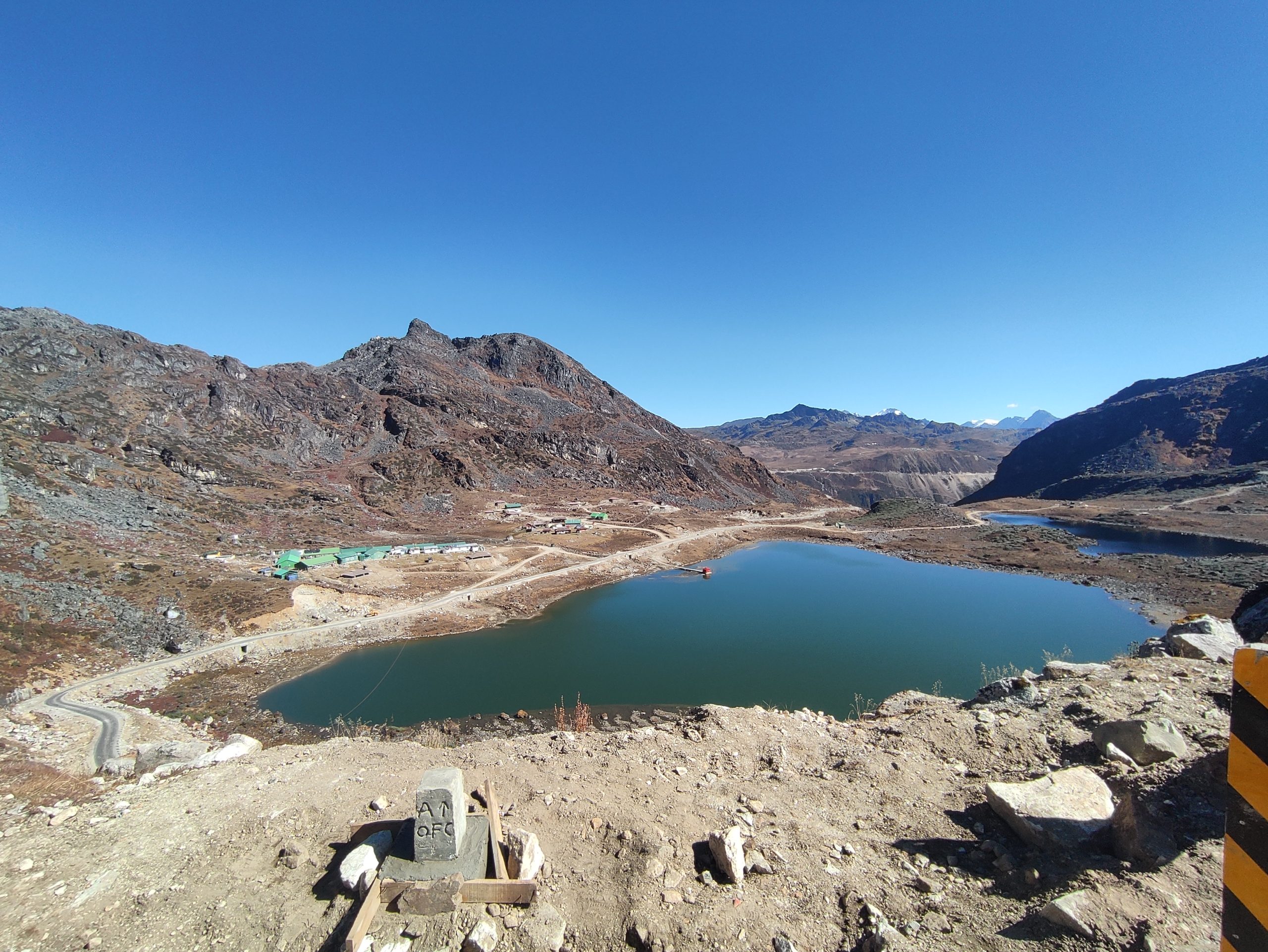
Ride Distance: 37 km approx. | Duration: 8-9hours approx. | Altitude: Bum La- 4633 m | Stay: Hotel. | GPS DATA
The summit day! Ride towards the legendary Bum La Pass, located on the Indo-China border. The route is steep and challenging, with thin air and often snowbound stretches, but the reward is immense—standing at 15,200 ft, overlooking the Eastern Himalayas. After celebrations at the top, descend back to Tawang.
Drive Distance: 170 km approx. | Drive Duration: 5-6 hours approx | Altitude: Bomdila- 55m | Stay: Hotel. | GPS DATA
A scenic drive retracing part of the cycling route through valleys and mountains. Overnight stay in Bomdila.
Drive Distance: 340 kms approx. | Drive Duration: 10-12 hours approx. | Altitude: Guwahati – 5602 m | GPS DATA
Drive back to Guwahati via the plains of Assam. The long drive offers beautiful landscapes one last time before you conclude the journey.