")


The Pangarchulla Trek is one of the most exhilarating high-altitude summit treks in the Garhwal region of Uttarakhand. Rising to an impressive 15,100 ft (4,602 m), Pangarchulla Peak offers the perfect mix of alpine beauty, snow adventures, and Himalayan grandeur.
The trail begins from the charming village of Joshimath and winds through lush forests of oak and rhododendron, vast meadows, and scenic campsites, before leading into snow-covered slopes and rocky ridges. During spring, trekkers are treated to the breathtaking sight of fresh snow, making the summit climb both challenging and rewarding.
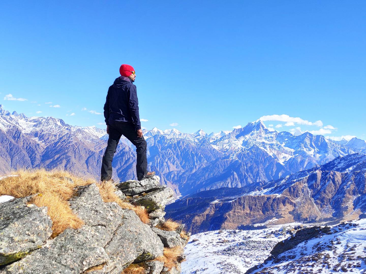
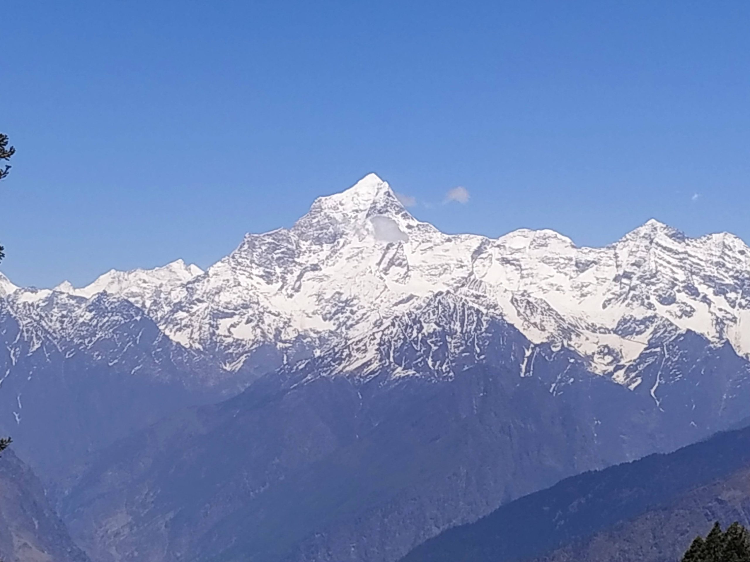
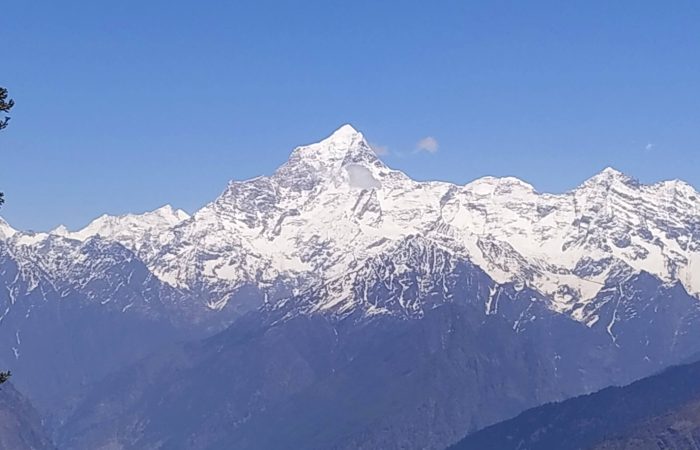
The trek provides panoramic views of some of the most iconic Himalayan peaks including Nanda Devi, Chaukhamba, Hathi Ghoda, Kamet, and Dronagiri. The final summit push is the highlight—demanding endurance, determination, and teamwork as you make your way to the top amidst rugged and steep terrain.
Whether you’re an adventure enthusiast seeking a tough climb or a mountain lover yearning for pristine Himalayan landscapes, Pangarchulla promises an unforgettable trekking experience filled with thrill, beauty, and accomplishment.
Drive Distance: 285 km | Drive Duration: 10-11 hours approx. | Altitude: Joshimath– 1875 m | Pick up point: ISBT, Dehradun.
Your journey begins early morning from Dehradun, as you set out on a scenic drive to Joshimath, the gateway to the Garhwal Himalayas. The route takes you along the charming hill towns, river valleys, and winding mountain roads of Uttarakhand, offering a glimpse of the state’s natural beauty and cultural richness.
The drive follows the course of the Alaknanda River, with mesmerizing views of terraced fields, coniferous forests, and distant Himalayan peaks. Along the way, you pass through Devprayag, Rudraprayag, and Karnaprayag—three of the sacred Panch Prayags (confluences), where tributaries merge with the mighty Alaknanda to form the holy Ganga. These spiritual and picturesque stopovers make the journey both enriching and memorable.
By late evening, you arrive at Joshimath (1,875 m), a vibrant hill town and base for several Himalayan treks and pilgrimages, including Badrinath, Auli, and Valley of Flowers. After the long yet beautiful drive, you check into your accommodation, enjoy a hearty dinner, and rest well to prepare for the adventure that lies ahead.
Drive Distance: 15 km | Drive Duration: 45 minutes approx. | Trek Distance: 3 km approx. | Trek Duration: 3-4 hours approx. | Altitude: Tugashi village – 2450 m | Gulling Top –2850 m. | GPS DATA
After an early breakfast at Joshimath, a short and scenic drive takes you to Tugashi village, the starting point of the trek. Tugashi is a small Himalayan hamlet surrounded by terraced fields, traditional stone houses, and a backdrop of towering mountains—offering a perfect glimpse into the local Garhwali lifestyle.
From Tugashi, the trek begins with a steady ascent through dense oak, rhododendron, and deodar forests. The trail is shaded and refreshing, with the sounds of birds echoing through the woods and occasional clearings opening up to reveal stunning views of Hathi Parbat and Dronagiri peaks. In spring, the rhododendrons bloom in vibrant shades of red and pink, adding magical colors to the trail.
As you gradually gain altitude, the air becomes crisper, and the forest opens up into the scenic meadows of Gulling Top (2,850 m)—your campsite for the night. From here, you are greeted with breathtaking vistas of snow-capped Himalayan ranges, and on clear evenings, the golden hues of sunset create an unforgettable atmosphere.
Spend the evening exploring the meadow, soaking in the serene mountain surroundings, and acclimatizing to the higher altitude. Overnight stay in tents under a star-studded sky.
Trek Distance: 5-6 km approx. | Trek Duration: 4-5 hrs approx. | Altitude: Khullara– 3350 m. | GPS DATA
After breakfast at the Gulling Top campsite, you begin your trek towards Khullara, a high-altitude meadow nestled amidst the Garhwal Himalayas. The trail gradually ascends through dense oak and rhododendron forests, with plenty of shaded paths and clearings that open into wide views of the surrounding mountains.
As you gain altitude, the forest begins to thin out and gives way to vast alpine meadows. The trek is moderately steep in sections but equally rewarding with every step. Along the route, you are treated to magnificent vistas of Dronagiri, Hathi Ghoda, and Nanda Devi in the distance. During spring, the meadows are often dotted with blooming rhododendrons, while in winter and early spring, the trail may be blanketed in snow, making the climb more adventurous.
By afternoon, you reach the Khullara campsite (3,350 m)—a stunning wide-open meadow surrounded by towering peaks and ridgelines. Khullara is also a junction point for multiple trekking routes, including the Kuari Pass trail. The site offers a perfect acclimatization stop before the demanding summit push of Pangarchulla in the coming days.
Spend the evening soaking in the mountain views, capturing sunset moments, and preparing for the adventure ahead. Overnight stay in tents at Khullara.
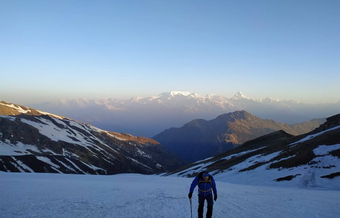
Trek Distance: 7 km approx. | Trek Duration: 5-6 hrs approx | Altitude: Kuari Top– 3800m | GPS DATA
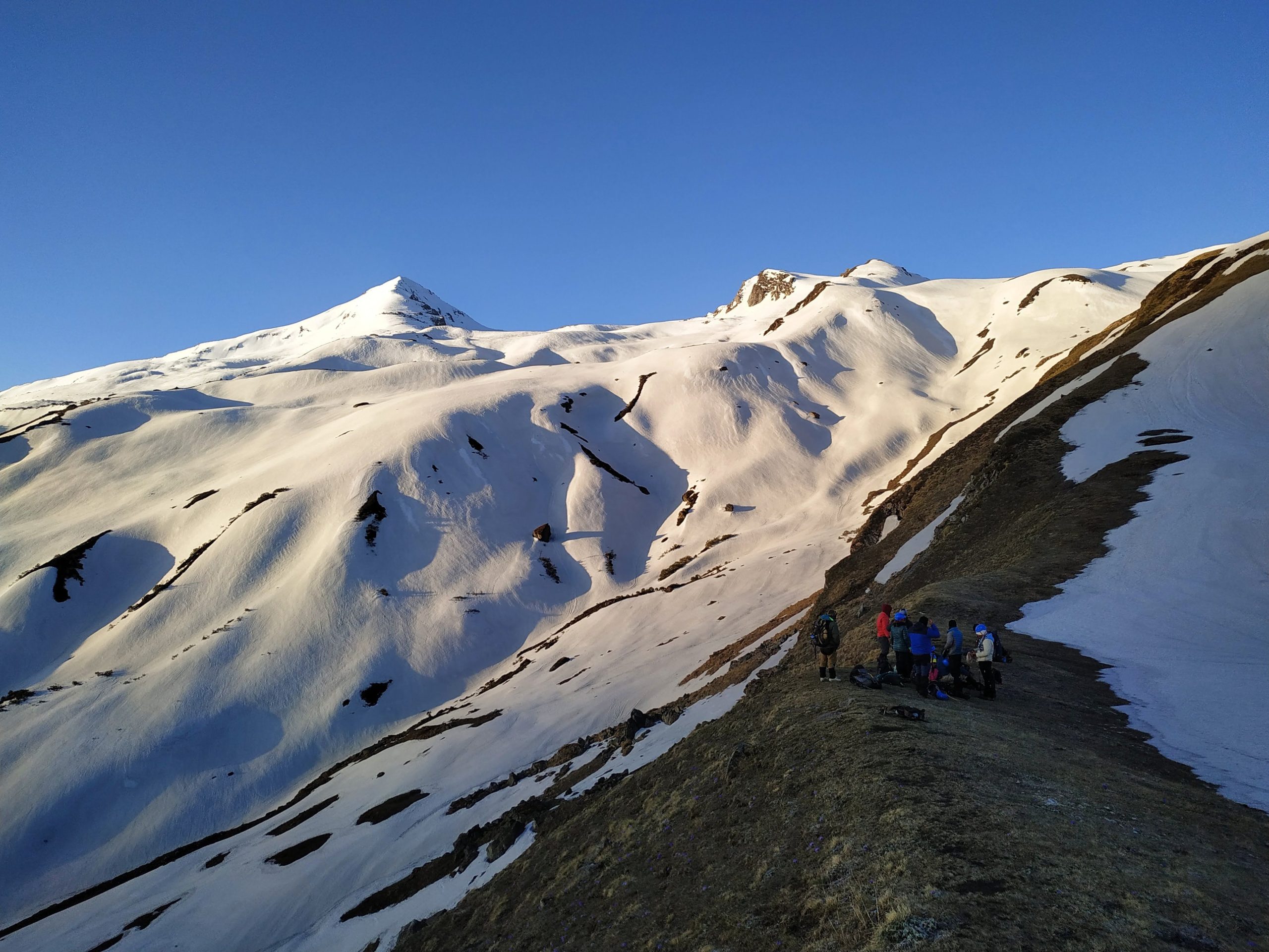
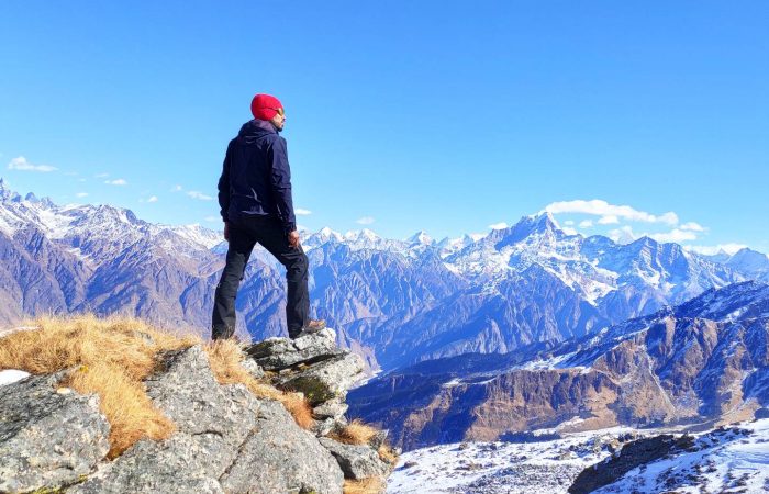
This day is reserved for acclimatization and preparation before the challenging Pangarchulla summit attempt. After breakfast at Khullara, you head out on a moderate trek towards Kuari Top (3,800 m)—a vantage point renowned for its sweeping Himalayan views.
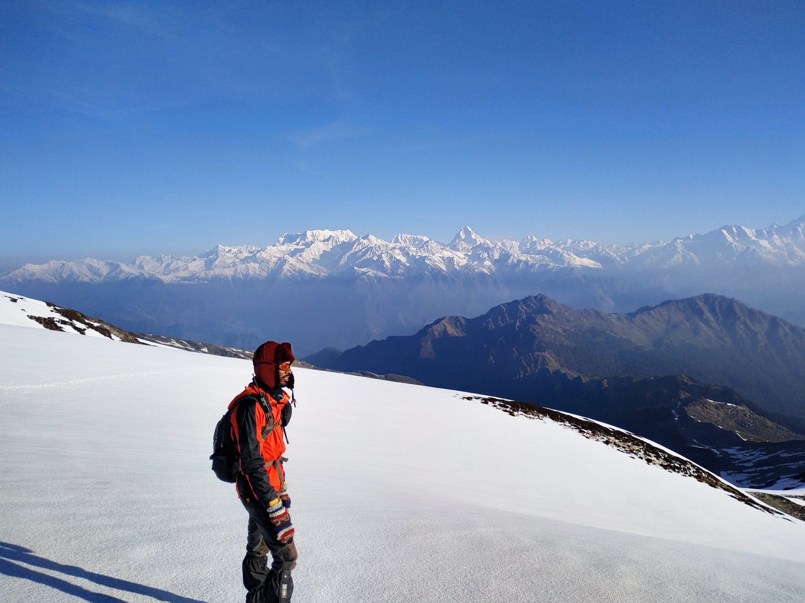
The trail ascends gradually from Khullara, crossing alpine meadows and ridgelines with the backdrop of towering snow peaks. As you climb higher, the panorama widens, offering uninterrupted views of the Nanda Devi Massif, Chaukhamba, Kamet, Trishul, Hathi Ghoda, and Dronagiri. Kuari Top is often considered one of the best Himalayan viewpoints, and standing here amidst the vast ranges is an experience in itself.
Depending on the season, you may encounter snow-patched trails in early spring or lush meadows in summer, making the trek equally enchanting in all conditions. After spending some time soaking in the breathtaking sights and capturing photographs, you retrace your steps back to Khullara campsite.
This acclimatization hike not only helps your body adjust to the higher altitude but also strengthens your confidence and stamina for the Pangarchulla summit push on the following day. Evening at leisure with a warm meal under the starlit sky. Overnight stay in tents at Khullara.
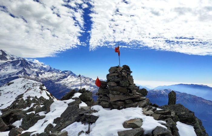
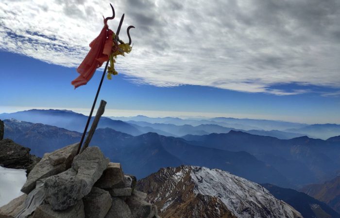
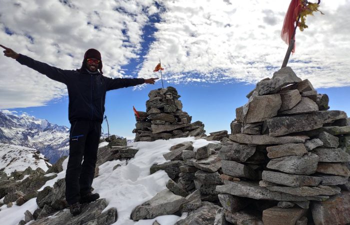
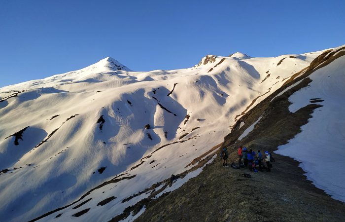
Trek Distance: 12 km approx. | Trek Duration: 10-12 hrs approx. | Altitude: Pangarchula Peak– 4602 m. | GPS DATA
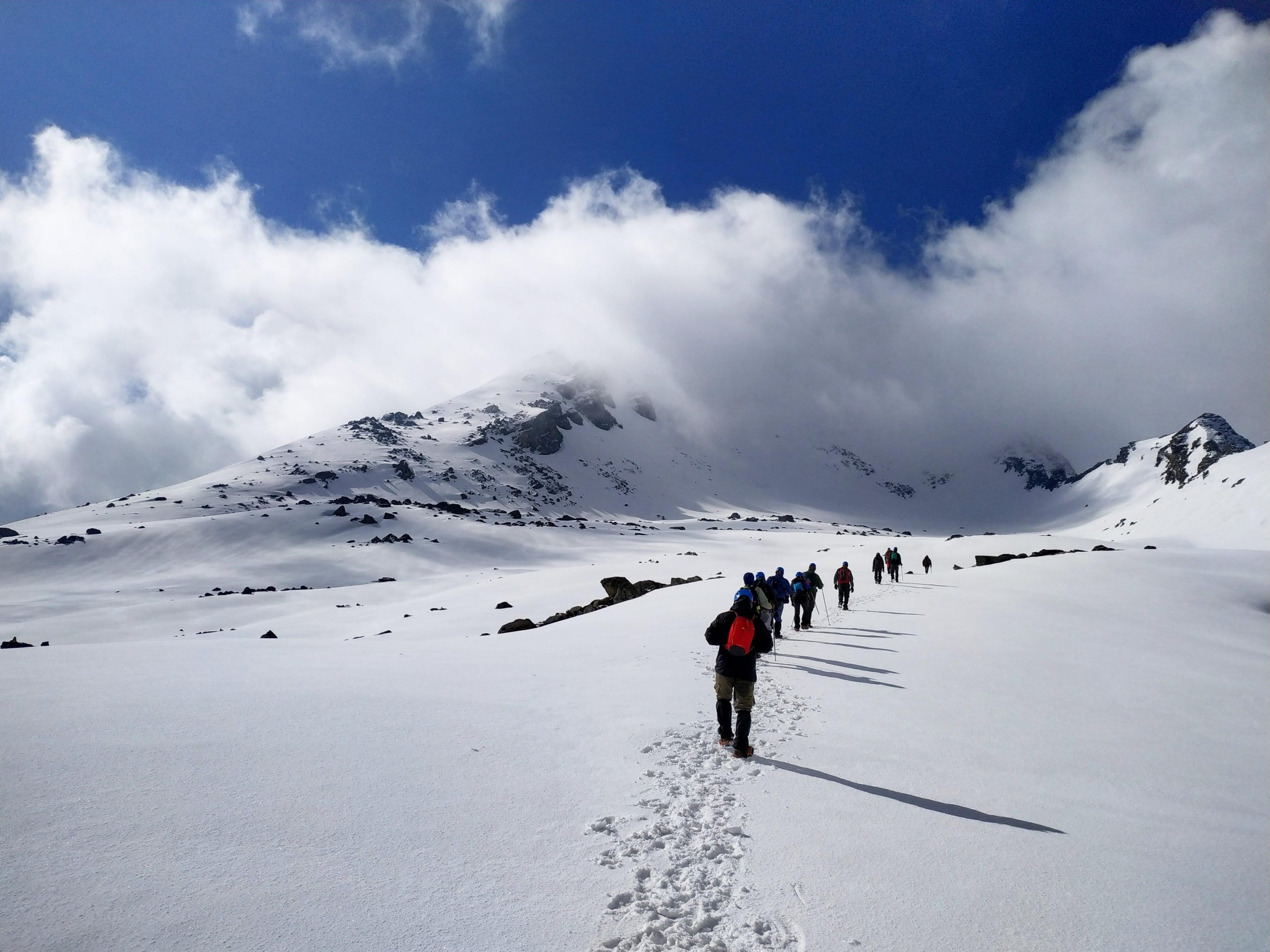
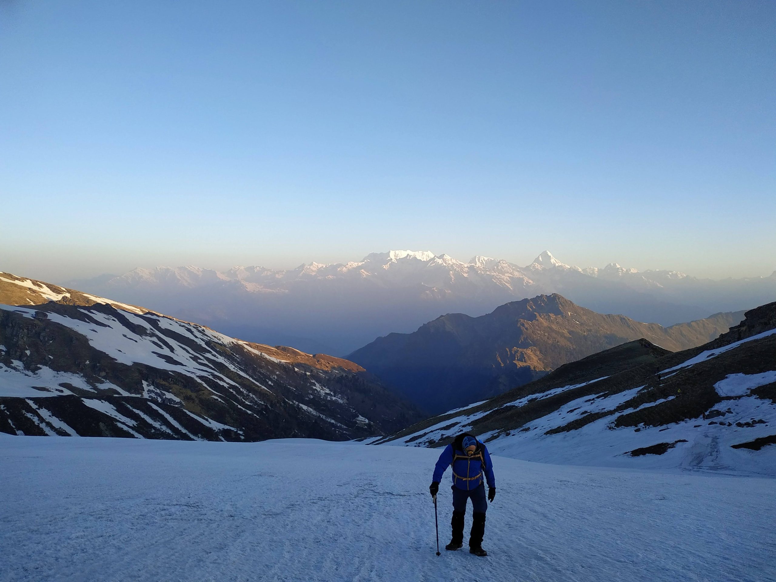
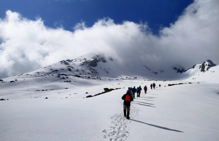
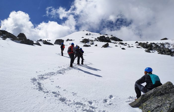
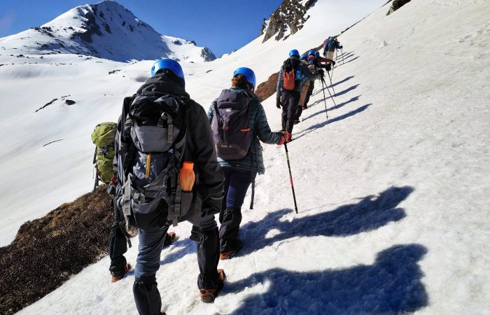
This is the most demanding and exciting day of the entire trek—the summit push to Pangarchulla Peak. You begin early in the morning, often before dawn, to make the most of firm snow conditions and to ensure a safe return before evening.
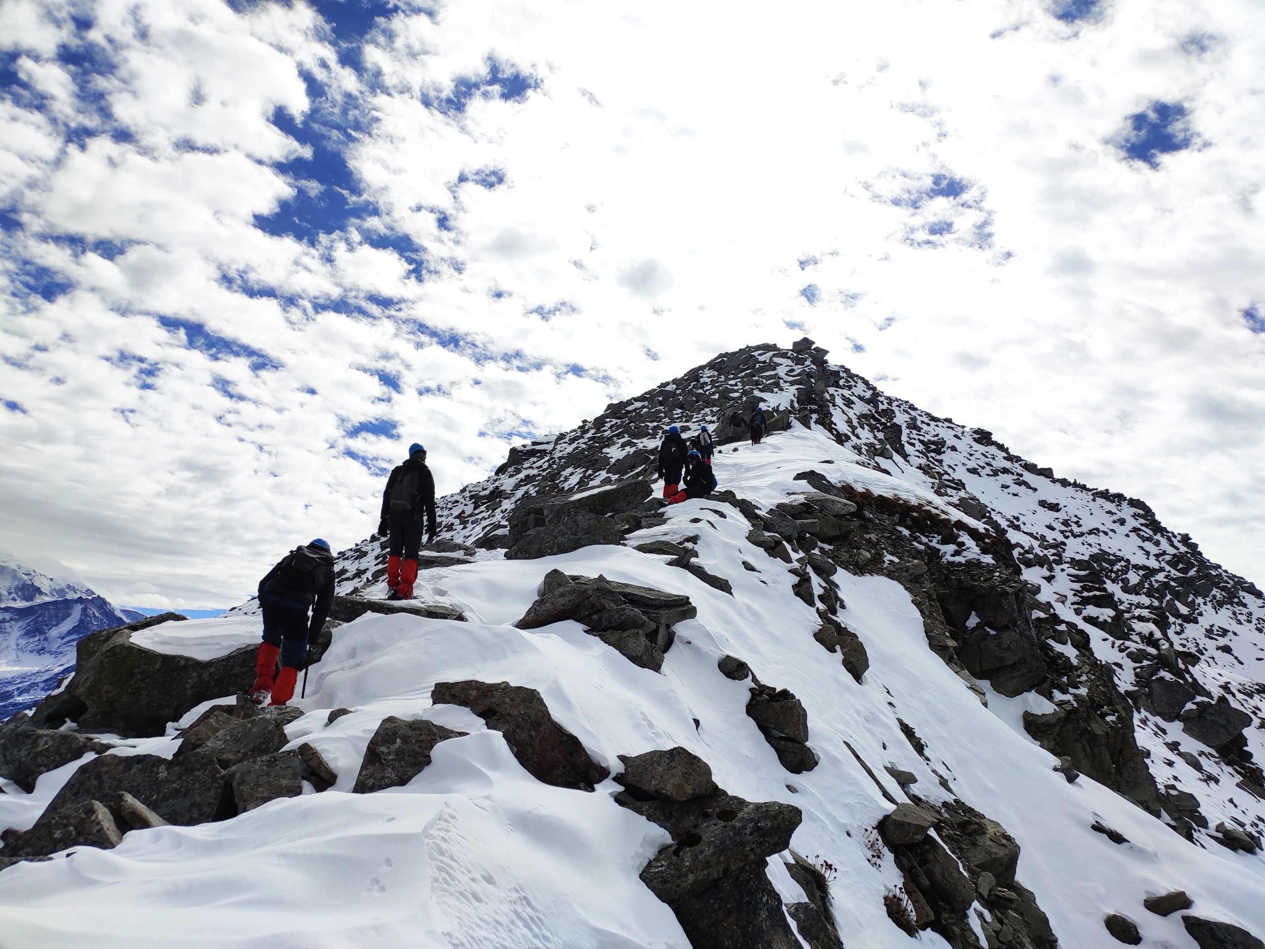
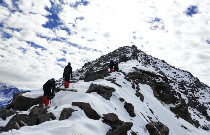
The trail from Khullara initially passes through rolling meadows before turning into steep ascents over rocky ridges and snow-covered slopes. The climb is gradual at first, but soon becomes challenging with multiple steep sections that test your stamina and determination. Depending on the season, you may have to traverse snowfields, boulder zones, and knife-edge ridges, each adding a new thrill to the adventure.
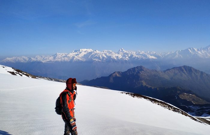
As you climb higher, the horizon unfolds into a breathtaking 360° panorama of Himalayan giants—including Nanda Devi, Chaukhamba, Kamet, Hathi Ghoda, Dronagiri, and Mana Parvat. The final ridge to the summit is the most exhilarating stretch, requiring focus, endurance, and team spirit as you inch closer to the peak.
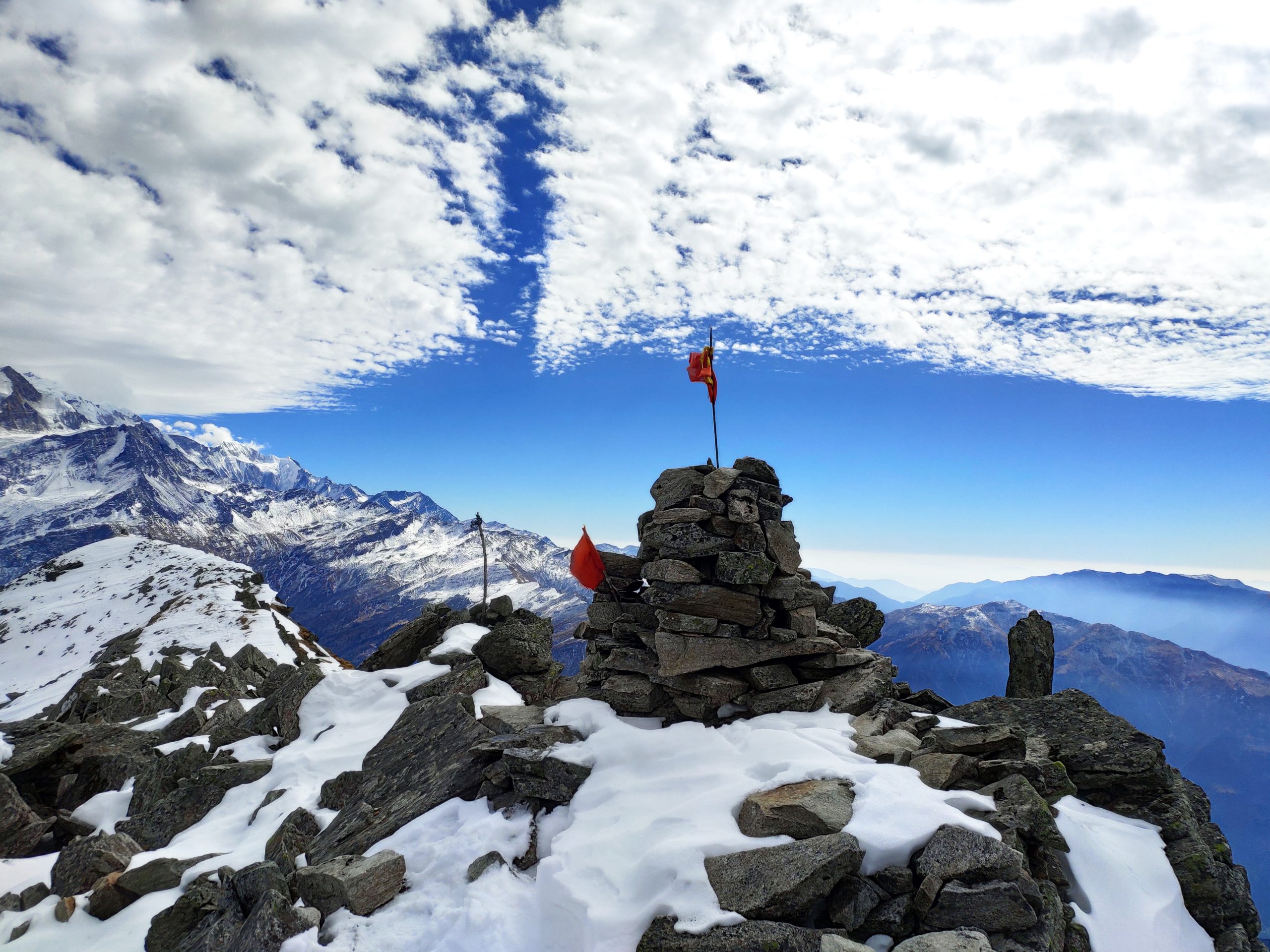
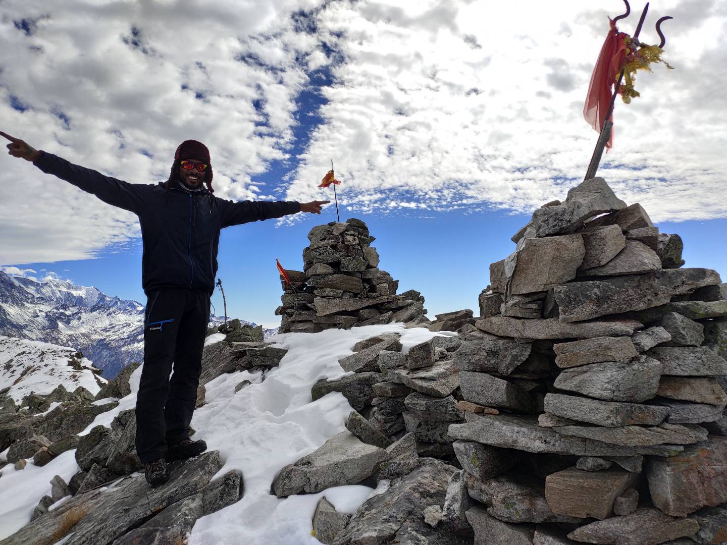
Standing atop Pangarchulla (4,602 m) is a moment of pure triumph. The vast snowfields, the endless ranges of the Garhwal Himalayas, and the sense of accomplishment make every effort worthwhile. After spending some precious moments celebrating and capturing the views, you begin your careful descent back to Khullara campsite, retracing your steps over the challenging terrain.
By evening, you return to camp tired yet exhilarated, with unforgettable summit memories to cherish forever. Overnight stay in tents at Khullara.
Drive Distance: 15 km | Drive Duration: 45 minutes approx. | Trek Distance: 7-8 km approx. | Trek Duration: 5-6 hrs approx. | Altitude: Joshimath– 1875 m | GPS DATA
After breakfast at Khullara, you begin your descent towards Tugashi village, retracing the trail through alpine meadows and dense oak and rhododendron forests. The downhill walk is easier on stamina but requires steady footing, especially in sections where the trail may be rocky or slippery. Along the way, you get to enjoy once again the changing landscapes—from wide-open mountain views to shaded forest paths filled with birdsong.
The trek takes you back to Tugashi village (2,450 m), where your vehicle awaits. A short and scenic drive of about 45 minutes brings you to Joshimath (1,875 m). After nearly a week in the wilderness, reaching Joshimath feels comforting—you return to warm beds, hot meals, and a chance to relax your tired muscles.
Evening is free to explore the quaint hill town, interact with locals, or simply rest. Joshimath also holds cultural and spiritual significance, being the base for the Badrinath pilgrimage and the gateway to Auli and several Himalayan expeditions. Overnight stay at a guesthouse/hotel in Joshimath.
Drive Distance: 285 km | Drive Duration: 10-11 hours approx. | Altitude: Dehradun– 600 m | Drop point: ISBT, Dehradun.
After an early breakfast at Joshimath, you begin your return journey to Dehradun, marking the conclusion of your Pangarchulla adventure. The drive retraces the scenic mountain roads, following the course of the Alaknanda River and passing through the holy confluences of Karnaprayag, Rudraprayag, and Devprayag—where tributaries merge to form the sacred Ganga.
The long yet picturesque journey takes you through charming towns, terraced fields, and forested valleys, offering plenty of time to reflect on the trek and the unforgettable summit experience. By evening, you arrive at Dehradun (600 m), where trekkers are dropped at ISBT for onward travel.
With hearts full of memories, camaraderie, and the triumph of scaling Pangarchulla Peak, the journey ends here—yet the spirit of the Himalayas stays with you forever.