Deprecated: Function WP_Dependencies->add_data() was called with an argument that is deprecated since version 6.9.0! IE conditional comments are ignored by all supported browsers. in /home/nomadicworldco/public_html/wp-includes/functions.php on line 6131
TAWANG BUM-LA CYCLING EXPEDITION - Nomadic World
+91 7037017755 , 8469231189 info@nomadicworld.co.in

TAWANG BUM-LA CYCLING EXPEDITION

Wish List

Adding item to wishlist requires an account

Pedal Power
From₹0₹0
0
Full Name*
Email Address*
Contact Number*
Your Enquiry*
* I agree with Terms of Service and Privacy Statement.
Please agree to all the terms and conditions before proceeding to the next step

Latest

ANNAPURNA CIRCUIT TREK

AALI BEDNI BUGYAL TREK

DEORIATAL CHANDRASHILA TREK

ANNAPURNA BASE CAMP (ABC)

Get a Question?

Do not hesitage to give us a call. We are an expert team and we are happy to talk to you.

+91 70370 17755

+91 84692 31189

info@nomadicworld.co.in

Ride to the Indo-China Border at 15,200 ft
  • Expedition Duration : 11 Days
  • Highest Altitude : 15200 ft (4633 m)
  • Basecamp : Guwahati
  • Grade: Moderate to Difficulty
  • Starting Point: Bhalukpong
  • Ride Distance : Approx. 350 km

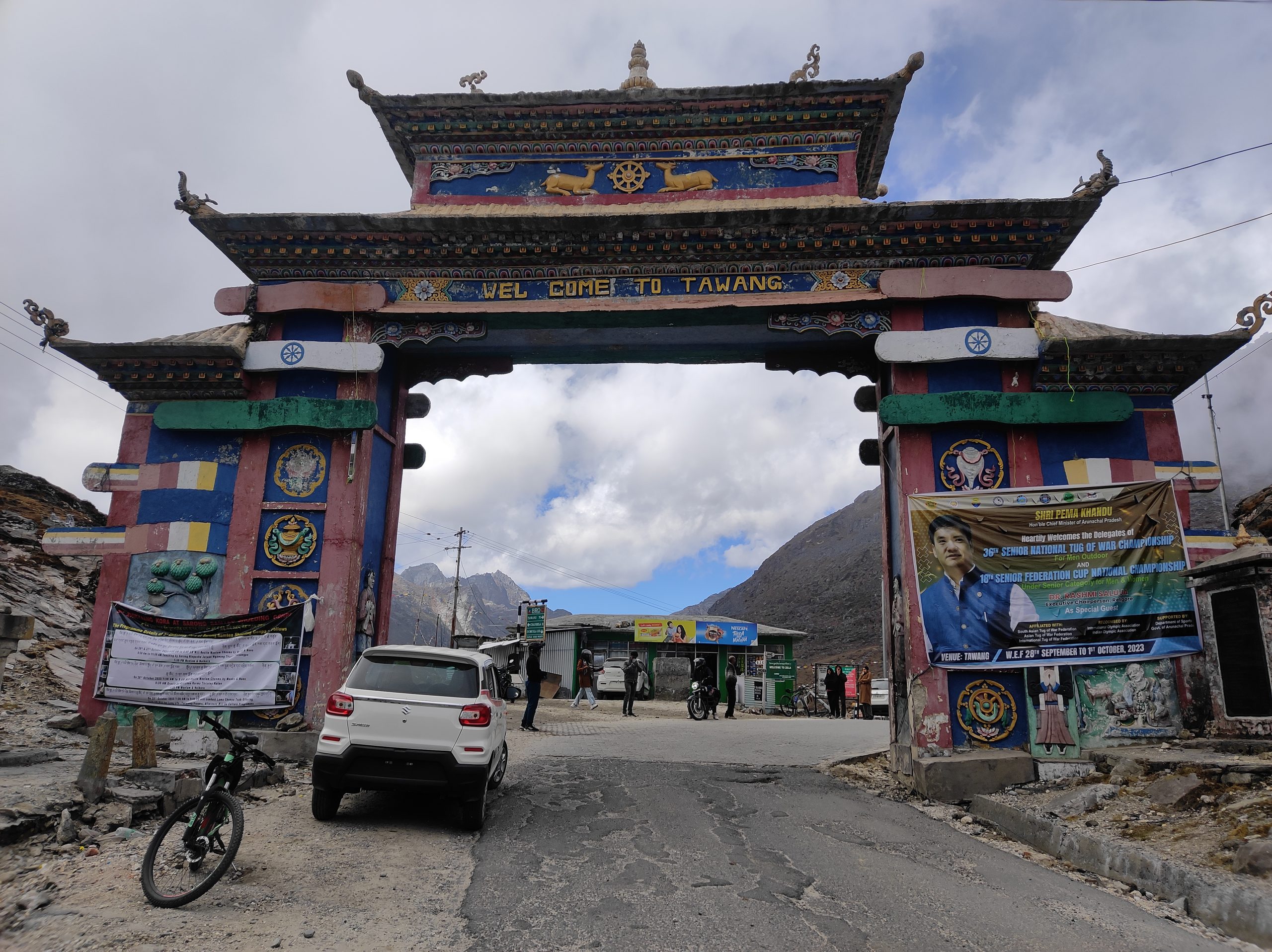
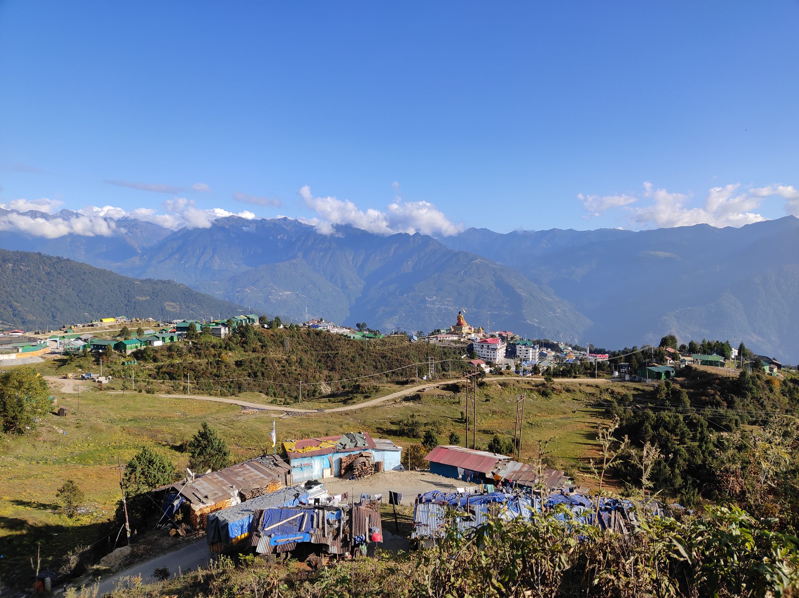
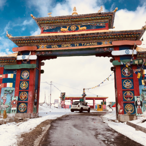
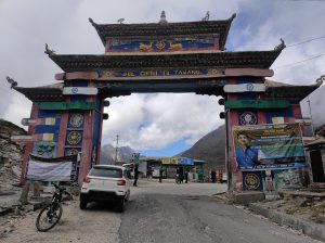
The Tawang – Bum La Cycling Expedition is a thrilling journey through the mystical landscapes of Arunachal Pradesh. Starting from the serene town of Tawang (10,000 ft), this adventure takes you along winding mountain roads, breathtaking valleys, and high-altitude passes — ultimately leading to the Bum La Pass (15,200 ft), a historic frontier on the Indo-China border.

Why This Expedition?

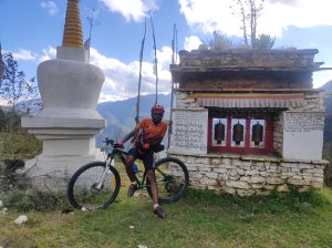
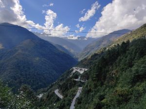
This expedition is not just a ride — it’s a blend of adventure, history, and culture. Every climb tests your stamina, every descent thrills your soul, and every turn opens up panoramic views of the Eastern Himalayas. As you pedal towards Bum La, you’ll be retracing paths steeped in history while soaking in the raw beauty of the North-East.

The Journey

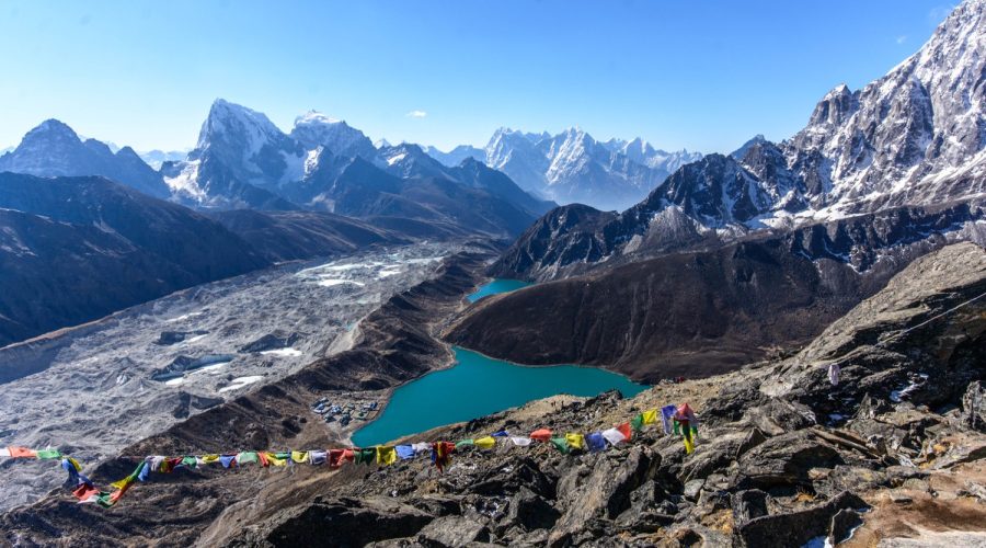
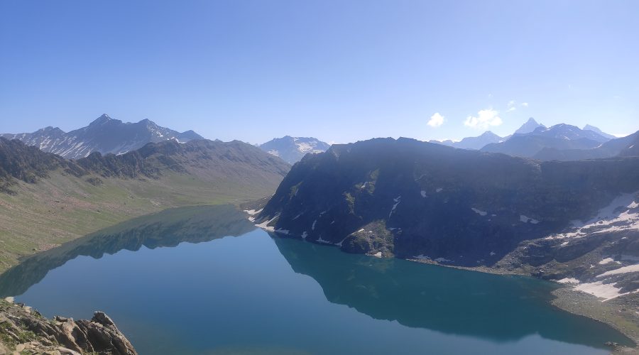
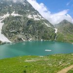
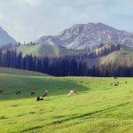
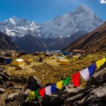
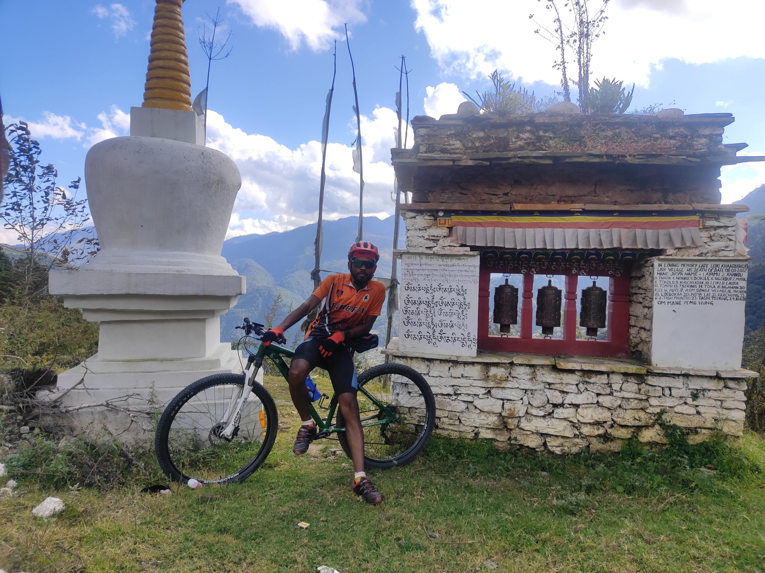
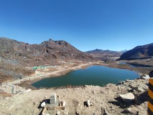
The ride begins from Tawang, winding past crystal-clear lakes, alpine meadows, and charming hamlets. You’ll ascend gradually towards Bum La, crossing winding mountain roads and feeling the thrill of riding in one of the most remote yet beautiful frontiers of India. Along the way, you’ll witness fluttering prayer flags, chortens, and the spiritual calm of monasteries — making this journey as soulful as it is adventurous.

Who Can Join?

This expedition is designed for cycling enthusiasts and adventure seekers who wish to explore North-East India in the most unique way possible. A good level of fitness and cycling experience is required to take on the high-altitude challenge.

A Journey of Adventure & Discovery

The Tawang – Bum La Cycling Expedition isn’t just about reaching the pass — it’s about experiencing the soulful land of Arunachal, embracing its culture, and riding through landscapes that few adventurers have explored.

🚴‍♀️ Join us for this unforgettable cycling adventure to the Indo-China border — and discover the North-East like never before.

ITINERARY

Day 1Arrival at Guwahati.

Briefing Duration: 2 hours approx. | Altitude: Guwahati – 55 m | Stay: Hotel.

Arrive at Guwahati, the gateway to Northeast India. Meet your expedition leader and fellow cyclists for a detailed briefing session on the route, safety instructions, high-altitude cycling, and team coordination. Evening is free to explore Guwahati city or rest before the journey.

Day 2Guwahati to Bhalukpong

Drive Distance: 240 km approx. | Drive Duration: 8-9 hours approx. | Altitude: Bhalukpong  – 213 m | Stay: Hotel. | GPS DATA

A scenic drive through Assam’s plains into the foothills of Arunachal Pradesh. You cross lush green tea gardens, Brahmaputra plains, and small towns before reaching Bhalukpong, the entry point to Arunachal Pradesh. Situated on the banks of the Kameng River, it’s a perfect spot to relax before starting the cycling adventure.

Day 3Bhalukpong to Jamiri.

Ride Distance: 60 km approx. | Duration: 7-8 hours approx. | Altitude: Jamiri –  1295 m | Stay: Hotel. | GPS DATA 

The first cycling day! The route gradually climbs into the Eastern Himalayas, with winding roads, forested slopes, and refreshing mountain streams. The ascent is steady and will test endurance as the altitude increases. You’ll end the day at Jamiri, a quiet mountain settlement surrounded by hills.

Day 4Jamiri to Bomdila.

Ride Distance: 50 km approx. | Duration: 6-7 hours approx. | Altitude: Bomdila  – 2415 m | Stay: Hotel. | GPS DATA 

A steep ascent day as you climb higher into Arunachal’s mountains. Bomdila is a bustling hill town known for its Buddhist monasteries, apple orchards, and stunning views of snow-clad ranges. The change in landscape and climate will be noticeable here as you pedal into cooler altitudes.

Day 5Bomdila to Sangti Valley.

Ride Distance: 50 km approx. | Duration: 7-8 hours approx. | Altitude: Sangti – 1652 m | Stay: Hotel. | GPS DATA 

A relatively easier day with mixed climbs and descents. The route takes you to Sangti Valley, one of the most picturesque valleys in Arunachal, famous for its lush meadows, pine forests, and black-necked cranes (seasonal migratory birds). A chance to unwind amidst pristine nature.

Day 6Sangti Valley to Senge.

Ride Distance: 35 km approx. | Duration: 5-6 hours approx. | Altitude: Senge – 2900 m | Stay: Hotel. | GPS DATA 

The road climbs steadily again as you move towards higher altitudes. You’ll feel the oxygen levels drop as the climb progresses. Senge is a mountain hamlet and an important stop before the climb to Se-La Pass.

Day 7Senge to Jung Via Se-La

Ride Distance: 66 km approx. | Duration: 8-9 hours approx. | Altitude: Se-La – 4200 m | Jung- 2400 m | Stay: Hotel. | GPS DATA 

A tough but rewarding day! The climb to Se-La Pass (13,700 ft / 4,200 m) is one of the highlights of the expedition. The road winds past alpine landscapes, frozen lakes, and snow walls. After crossing the pass, enjoy a thrilling descent into Jung, a village surrounded by waterfalls and valleys.


Day 8Jung to Tawang.

Ride Distance: 40 km approx. | Duration: 6-7 hours approx. | Altitude: Tawang- 3048 m | Stay: Hotel. | GPS DATA 

A shorter but scenic ride to Tawang, the cultural heart of Arunachal Pradesh. Tawang is home to the famous Tawang Monastery, the second-largest in the world. Evening free to explore local markets and monasteries.

Day 9Tawang to Bum La and Back to Tawang .

Ride Distance: 37 km approx. | Duration: 8-9hours approx. | Altitude: Bum La- 4633 m | Stay: Hotel. | GPS DATA 

The summit day! Ride towards the legendary Bum La Pass, located on the Indo-China border. The route is steep and challenging, with thin air and often snowbound stretches, but the reward is immense—standing at 15,200 ft, overlooking the Eastern Himalayas. After celebrations at the top, descend back to Tawang.

Day 10Drive from Tawang to Bomdila.

Drive Distance: 170 km approx. | Drive Duration: 5-6 hours approx | Altitude: Bomdila- 55m | Stay: Hotel. | GPS DATA 

A scenic drive retracing part of the cycling route through valleys and mountains. Overnight stay in Bomdila.

Day 11Drive from Bomdila to Guwahati.

Drive Distance: 340 kms approx. | Drive Duration: 10-12 hours approx. | Altitude: Guwahati – 5602 m | GPS DATA 

Drive back to Guwahati via the plains of Assam. The long drive offers beautiful landscapes one last time before you conclude the journey.

PRICE

Service :Guwahati to Guwahati
on demand
  • Inclusion

    • All Meals during the expedition (Starting Dinner on Day 2 till Breakfast on Day 10).
    • All accommodations during the tour are on a sharing basis.
    • Support vehicle for Riders.
    • Services of a First Aid certified expedition leader & assistant. Leader in a group of 12.
    • Services of the support team.
    • Certified first aid support & kit includes an Oxygen Cylinder.
    • Hydration and nutrition support.
    • 1 bag, preferably a rucksack (Up to 80 liters), brought by the participant to be accommodated in the support vehicle. Please avoid suitcases and trolley bags.

  • Exclusion

    • Bicycle Rent.

    • Single Stay in Hotel/Guest House.

    • Meals during Hotel Stays in Guwahati and.

    • Any Kind of Insurance.

    • Any expense of a personal nature.

    • Any expense not specified in the inclusion list.

CANCELLATION POLICY & REFUND POLICY

  • Special Cancellation Policy 

       A) We have implemented a special cancellation policy:

  1.  Before 60 Days: 90% Refund.
  2.  31-60 Days: 75% Refund.
  3.  Within 30 Days: 50% Refund.
  4.  Within 14 Days: No Refund.

Payment & Booking Policy

A booking fee of ₹10,000 is required to confirm your spot. The remaining trek fee must be paid at least 15 days before the trek start date. If the full payment is not received on time, your booking may be cancelled. The ₹10,000 booking fee is non-refundable under any circumstances.

Our cancellation policy applies to the entire trek fee, not just the booking amount. For any questions or assistance with payment, feel free to contact us.

       B) Rescheduling Policy

  • Rescheduling Within the Same Trip or Changing the Trek.
  • Rescheduling is subject to availability. Trek costs may vary depending on the location and will be adjusted accordingly.
  • Guests have the option to reschedule their trek and utilize the amount paid within 1 year.


  • Refund Process: Refunds will be issued by mail only and processed within 15 business days from the date of cancellation.
  • Unforeseen Changes: In the event of an emergency, we may reroute treks to alternative trails. Mental preparedness for such situations is advised.
  • Documents Required: Trekkers must carry a photocopy of their photo ID, along with the mandatory Medical Certificate and Disclaimer forms for trek permissions before and during the trek

PACKING LIST

Please ensure you bring all essential items with you:

 Mandatory Items:

⦁ Helmet -1.

⦁ Cycling Gloves – 1 Pair.

⦁ Front Headlight – 1.

⦁ UV Protection Goggles – 2 (1 you can have for safety) (choose sunglasses suitable for Cycling).

⦁ Water bottles/ Sipper: 2 bottles of 1 liter each

⦁ Tail Light – 1.

Footwear:

⦁ Cycling shoes Or Sports Shoes – 1 Pair (Clipless Or stiff-soled).

⦁ Pair of lightweight slippers/sandals – 1 Pair (Post Ride Comfort).

Clothing & Cycling Gears:

⦁ Quick-dry warm lower or track pants – 2 (Post Ride Comfort).

⦁ Cycling Jerseys or Dry–Fit T-shirts – 4-5

⦁ Padded Cycling Shorts – 3-4 (Gel-padded).

⦁ Socks – 5-6 cotton socks and 2 pairs of woolen socks for the night.

⦁ Thermal body warmer upper & lower – 1 set

⦁ Undergarment as per your requirement

⦁ Warm down Padded Jacket closed at wrist & neck – 1

⦁ Fleece- 1

⦁ Buff/Neck Warmer – 2

⦁ Rainwear (jacket & pants) – 1

⦁ waterproofs, warm gloves – 1 Pair

⦁ Woolen cap – 1

⦁ Windproof Jacket – 1

⦁ Sun shielding hat – 1

⦁ Knee Cap- 1 Pair

⦁ Day Bag with Rain Cover.

Toiletries:

⦁ Personal toiletries kit (small towel, toilet paper, paper soap, bar soap, toothbrush, toothpaste, cold cream, etc.)

⦁ Sunscreen lotion SPF50 small pack – 1

⦁ Lip balm small pack – 1

Miscellaneous:

⦁ Camera (optional)

⦁ Carry plenty of medicines in plenty in case you have any specific ailment. Consult your doctor before joining the trek.

⦁ Dry fruits, nuts, chocolate, candies, Energy bars (optional)

⦁ Ensure you pack all essential items and consider optional items based on your personal preferences and requirements.

Highlights of Trek
  • Bum La Pass – High-altitude border pass at 15,200 ft with stunning Himalayan views and patriotic significance.
  • Tawang Monastery – Largest monastery in India, rich in Buddhist heritage and serene ambience.
  • Sangetsar (Madhuri) Lake – Pristine high-altitude lake surrounded by mountains and pine forests.
  • Scenic High-Mountain Roads – Winding hairpin bends, steep climbs, and panoramic valleys.
  • War Memorial – Tribute to the heroes of the 1962 Indo-China war.
  • Snow-Covered Peaks & Meadows – Ever-changing landscapes from alpine valleys to snowy ridges.
  • Local Culture & Monpa Hospitality – Experience traditional food, attire, and warm smiles of locals.
FAQ

What about acclimatization?

Tawang lies at a high altitude (10,000+ ft). We include acclimatization days in Tawang before cycling to Bum La Pass, so your body adjusts to the thinner air gradually.

What kind of accommodation is provided?

Accommodation is arranged in comfortable hotels/guesthouses in Tawang and nearby villages. On the route, simple homestays and camps may also be used to give you a local experience.

What is the best time for this expedition?

The best time is April to June and September to November, when weather conditions are pleasant and roads to Bum La are open. Winters are too harsh for cycling here.

How do I prepare for this cycling expedition?

This ride involves steep climbs and high-altitude cycling. We recommend consistent cycling practice, endurance training, and cardio workouts at least 2–3 months before the trip.

What if I cannot complete the expedition?

No worries—your safety comes first. A support vehicle will always be available. If you’re unable to continue riding, you can still travel with the group by vehicle.

Can I bring my own cycle?

Yes, you can bring your own cycle if it’s well-maintained and suited for high-altitude terrain. If needed, we can help arrange rental bikes in advance.

What is the group size?

We limit the group size to 10 participants for better safety, personalized guidance, and smoother logistics.

How can I book the trek?

To initiate your booking:
Fill out the inquiry form on our website or contact us directly.
Our Operational Manager will reach out for a brief consultation.
Once confirmed, you’ll receive a detailed email with the booking process, payment details, and pre-trek checklist.


Still Have Questions?

Feel free to reach out to our team via info@nomadicworld.co.in OR Contact us We’re here to help you prepare for a safe, enjoyable, and memorable Himalayan experience.